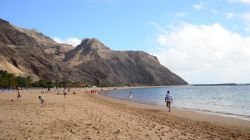
Chances of a tropical cyclone forming near the Canary Islands increase to 70%
According to information updated by the National Hurricane Center, the chances of a tropical cyclone forming near the Canaries have increased to 70% (yesterday the estimate was at 60%).
Aemet has activated a yellow warning due to accumulated precipitation for Sunday, covering the entire Canary Islands archipelago.
Intense rain is expected in some areas of the archipelago, although at the moment it is hard to estimate exactly how much the islands will be affected by the passing of this storm in their proximity.
Update - The cyclone is now classed as Tropical Storm Hermine, due to its rapidly increasing strength
However, it is estimated that Sunday will be the day with the worst weather and most chances of precipitation, storms and strong wind at high altitudes, although for the islands of Fuerteventura and Lanzarote it is forecasted that the rain will not be as intense as in the western part of the archipelago.
Please keep in mind that according to forecasts, the cyclone will not impact the Canary Islands directly, but as it passes near the archipelago, it will cause intense rain, some storms and strong wind gusts at high altitudes.
This is the official update from the National Hurricane Center
A broad area of low pressure, located roughly in between the Cabo
Verde islands to the east and the west coast of Africa, is producing
a large area of showers and thunderstorms. While this activity is
gradually becoming better organized, earlier satellite wind data
indicated the circulation remained fairly broad. Environmental
conditions are forecast to be generally conducive for some
development over the next day or so, and a tropical depression is
likely to form by this weekend while the system moves northward at
about 10 mph, parallel to the coast of west Africa.
- Formation chance through 48 hours...high...70%
- Formation chance through 5 days...high...70%


