Heavy rains in the Canary Islands from this afternoon as Storm Hermine advances

The National Hurricane Center has issued Advisory no. 4 and warns about heavy rains in the Canary Islands caused by the approach of Tropical Storm Hermine.
Based on current estimates, maximum sustained winds near 40 mph (65 km/h) with higher gusts are expected. Weakening is expected to commence tonight, and Hermine could become a remnant low on Monday.
Tropical-storm-force winds extend outward up to 45 miles (75 km) from the center Tropical Storm Hermine is expected to produce 3 to 6 (75 to 150 mm) inches of rainfall with localized higher amounts up to 10 inches (250 mm) across the Canary Islands through this weekend. This rainfall may cause some flash flooding in areas of higher terrain.
Initially, the NHC had predicted rainfall amounts up to 150 mm, although in this new advisory it has updated the amount to 250 mm, especially in the western islands of the archipelago.
UPDATE: Gran Canaria, La Palma and El Hierro have been update to Red warning due to the high amount of precipitation forecasted: 120 mm in Gran Canaria and 180 mm in El Hierro and La Palma in 12 hours. Tenerife remains under Orange alert for the moment.
The code red issued for Gran Canaria mainly covers the eastern side of the island, but also the south and west.
Rainfall has already started in some parts of the Canaries since last night, although it has been moderate rain up until this point. Based on the current forecast, Tenerife, La Gomera and La Palma will be the islands most affected by the pass of storm Hermine, with the highest forecasted amounts of precipitation. Wind gusts of up to 70km/h are also expected in these islands on Sunday.
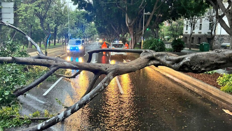
Update - Sunday, September 25: Hermine downgraded to a tropical depression, still causes heavy rain and incidents in the Canary Islands
Since this is predicted to be the most serious episode of rain in the Canary Islands in the last few years, we remind you that the authorities have issued a maximum alert, so all public events are suspended and you should not go out on trails on the mountains, as there's also warning about the possibility of flash flooding.


